


Day Hikes Around Los Angeles app for iPhone and iPad
Developer: Jacob Schirm
First release : 05 Jun 2015
App size: 42.76 Mb
LA Times Best Seller and four-time award winner from three Outdoor Writers Associations (including Best in Show and Best Guidebook). Now in its 6th edition, Day Hikes Around Los Angeles includes 160 hikes in and around a 50-mile radius of the city. Residents and adventuresome travelers will find the book essential to discovering an amazing number of hiking opportunities.
The Los Angeles Day Hikes App brings to your iPhone the 6th Edition of Robert Stones classic "Day Hikes Around Los Angeles" field-guide.
- 160 day hikes within 50-mile radius of the city
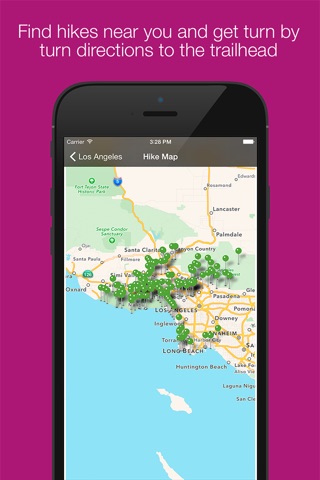
- View and select hikes from a map
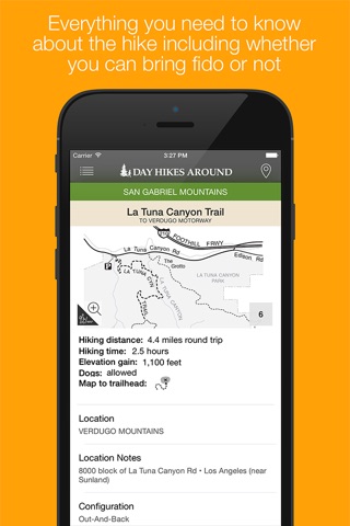
- Quickly review hike summary, map, directions, distance and time
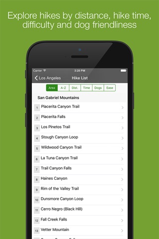
- Filter hikes by time, distance, difficulty and dog friendliness
- Generate turn by turn directions to hikes using Apple maps
Despite the widespread presence of the Los Angeles metropolis, there exist thousands of acres of natural, undeveloped land and countless out-of-the-way hiking trails. Now in its 6th edition, Day Hikes Around Los Angeles includes 160 day hikes within a 50-mile radius of the city, providing access to the area’s cherished green space and disclosing many entry points to the coast. Most hikes are located in public open space (local, state, and national), wilderness areas, in the expansive Santa Monica Mountains National Recreation Area, and within the San Gabriel Mountain Range. A few metropolitan strolls are included as well.
These hikes provide an excellent cross-section of scenery and difficulty levels, ranging from coastal beach walks to steep canyon climbs with far- reaching views. Hiking times range from 30 minutes to seven hours, although the majority of hikes are 2–6 miles in length. Relevant maps are listed under the statistics to lengthen the hike. A quick glance at the hikes’ statistics and summaries will allow you to choose a hike that is appropriate to your ability and intentions. The first overall map identifies the general locations of the hikes and major access roads. Several other regional maps (underlined in the table of contents), as well as maps for each hike, provide the essential details. The Thomas Guide, or other comparable street guide, is useful for navigating through the metropolitan areas.